Rutland, Iowa (The way we were):
Main page
Map
Yearbook
Photos
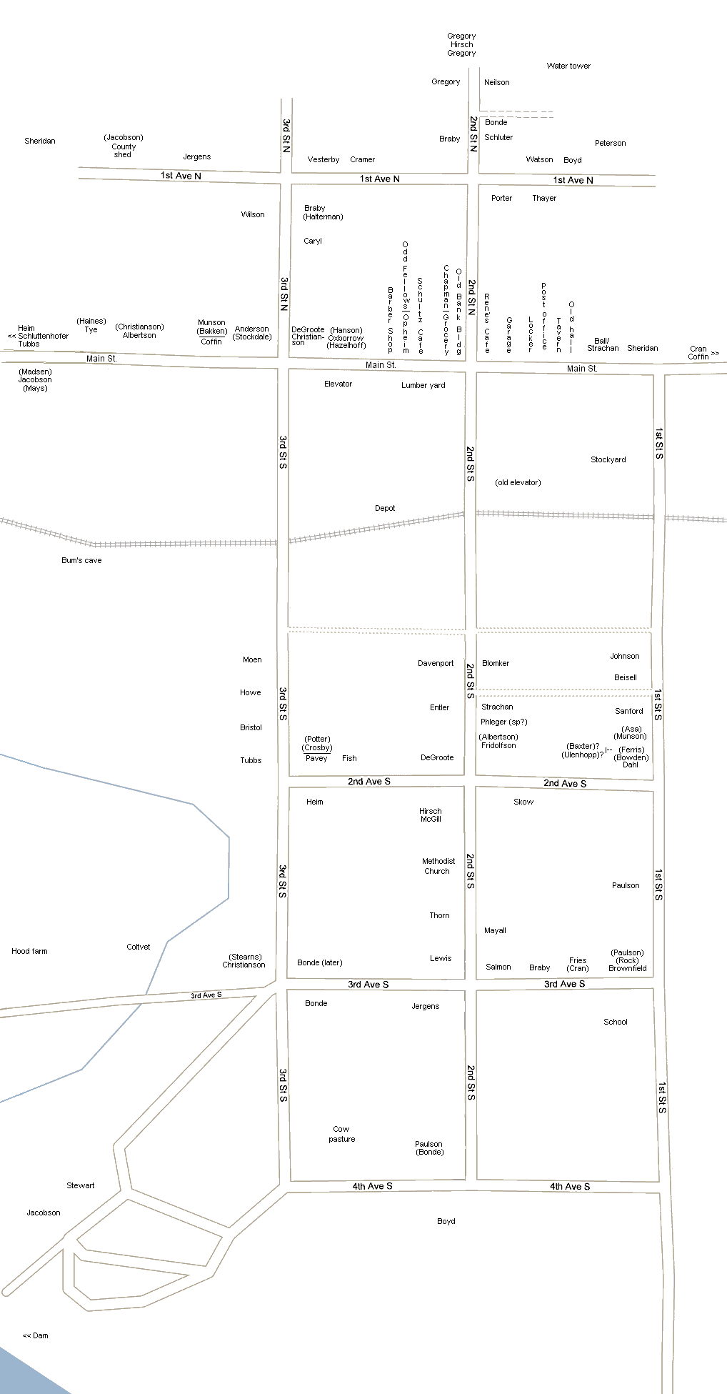
Rutland, Iowa, early 1950s
This map is intended to show homes and businesses that existed in Rutland from January 1, 1950 to December 31, 1954. If you have any additions or changes, please e-mail
cybraria@frontiernet.net
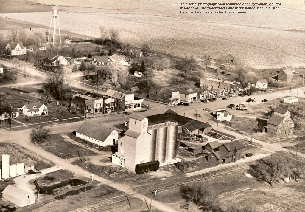
Aerial photo (partial)
Rutland Township plat map, 1955
Back to top of page
Back to top of page