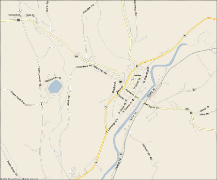
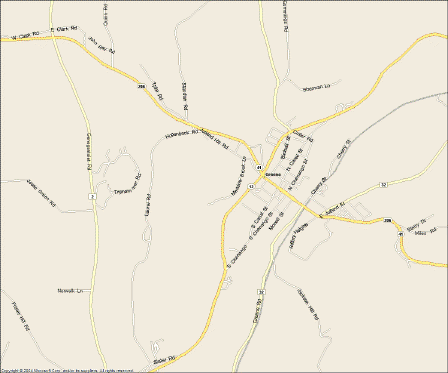
(Water Landmarks Missing!)
Map image is of Greene, NY, USA It shows a major river in this area called the Chenango River, running through Chenango County next to Chenango Street on one side and Water Street on the other. Lake Patonia is the lake to the left that is missing in the 2005 version.
The 2002 version shows the river at all close-up zoom levels. The 2005 version only shows the Chenango River at one specific zoom level. This is unacceptable in a mapping program as water landmarks are often used to verify your position along a road. If they don't appear on the map, this important navigation tool is gone.
Because the rivers, streams and certain size lakes can be seen in the 2005 version at certain zoom levels, the map data has to exist. Based on that, I conclude that the viewing algorithm in Streets and Trips is preventing the water landmarks from being viewed. This should be changed to a configurable option on the view menu or simply change back to the viewing algorithm used in the 2002 version.
Tim Hanna