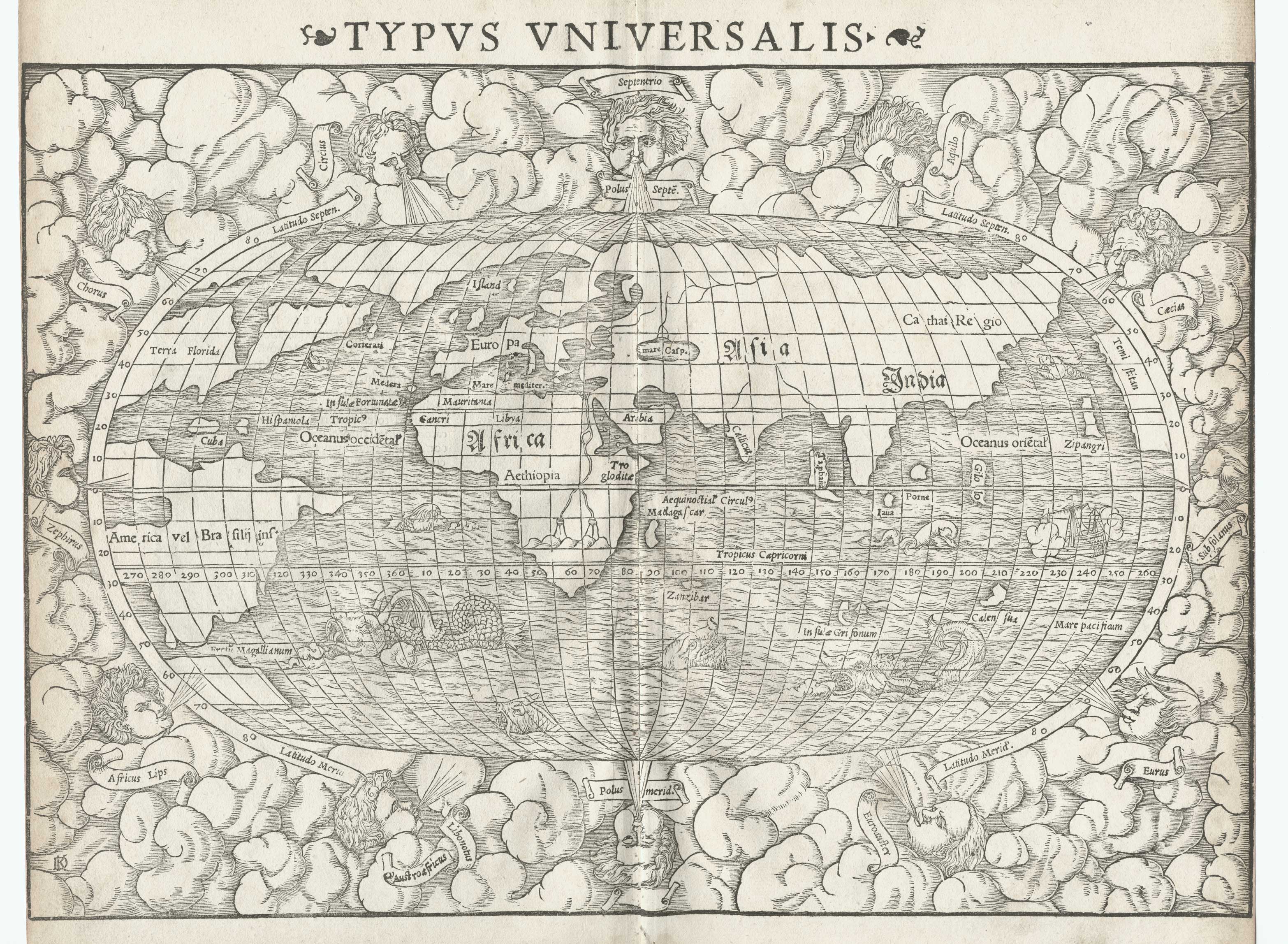
This Map is the source of the Wind Head images on this site. The twelve winds are of course interesting, and are here named, from the left and going clockwise, Zephirus, Chorus, Circius, Septentrio, Aquilo, Caecias, Subsolanus, Eurus, Euroauster, (Notus?), Austroafricus, and Africus Lips.
I believe it is by Sebastian Munster, circa 1560, but I am not sure. Other very similar maps are by to him, but there are slight differences in the plates. Plates were often shared or passed around and I am by no means an expert. In any event, it is a beautifully decorative and telling map, both because of and in addition to the Wind Heads. Sea monsters and Terra Incognita abound. The theorized