KÏI
CXpedition
August 18, 2007
Photos taken by Jeffrey Nast KCÏMKS
About Knife Island
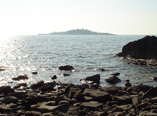
Knife Island is a small piece of rock only about 1,200 feet from the mouth of the Knife River Marina:
Google Maps
TopoZone
ACME Mapper
As you can see from the "Google Maps" aerial photo in the link above, there are some water hazards that need to be addressed in our travels to and from the island.
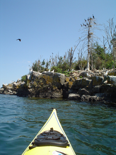
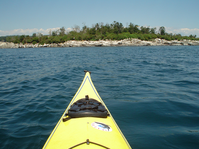
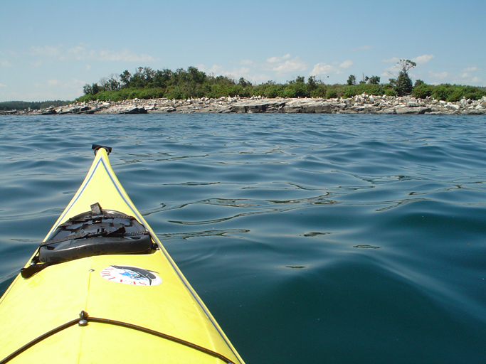
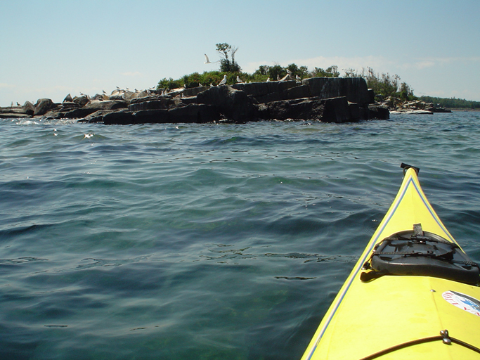
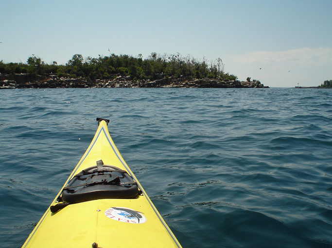
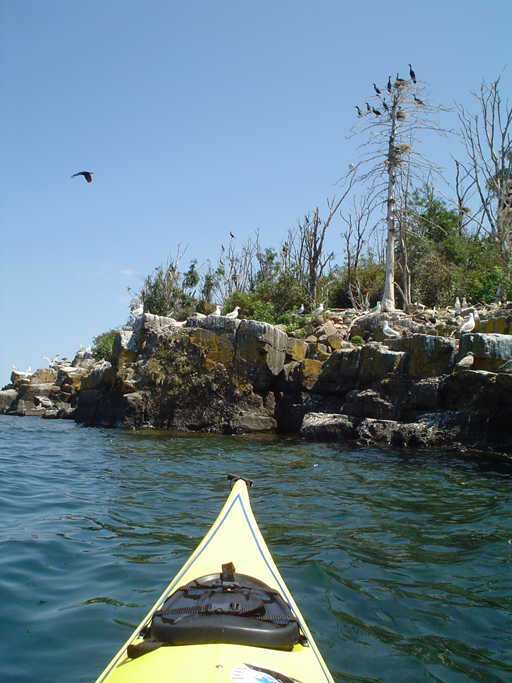
The island itself has exposed rock, small shrubs and a number of 20'-30' trees. The local inhabitants (Gulls, Commorants, Geese...) should be done nesting by this time, so we hopefully won't be interfering with the nesting season. Though I still think there will be a fair amount of "dive-bombing" by the local inhabitants to try and scare us off their rock.
Speaking of flora and fauna... Since the birds own the island, there is plenty of white wash to go around. Many pre-processed fish and french fries (that's what the tourists feed the gulls...) have been deposited here! There is an odor on and around the island. It is not a rank or a stench odor such as rotting animals, but none the less there is a strong odor. My goal is to set up as close to possible on the windward side of the island to help mitigate the odor. Then the wind will switch... HI! I'm hoping for a good soaking rain to cleanse the island before we get there...
The local humans consider the island as a "bird sanctuary". There is no official governing body that will admit to that, and there is no signage on the island to that effect. If we were to be bothered by the locals or even tourists... one plan is to have Ray and Deb dress up in their best naturalist outfits (Dr. and Mrs. Livingston?) and then we have the excuse that we are providing communications for a very important field biology exploration team.
See the bottom of this web page for more photos of the island and our operations!
About the KÏI Knife Island CXpedition
Please visit the QRZ web site for QSL information:
In order to try and eliminate QRM between the KÏI stations, I was hoping to arrange the antennas as follows:
- G5RV in the middle of the island, using the "trees" (and nests) for support. Such as it may be...
- Both the verticals (SSB and CW) on opposite ends of the island.
This would mean that we would need lots of extension coax.
I will have an HT with, for ship to shore, island to shore, island to ship communications. I also plan on getting into the ARAC and LSAC repeaters to advertise our position and frequencies. Feel free to bring an HT along for backup communications...
One last word before you go... I want this to be a "fun" outing. I'm not looking to get the most number of contacts ever, no pressure there!. Go at your own speed, have fun. If pileups happen, switch gears and "git 'r done"!
Operators:
- Jeff Nast KCÏMKS (SSB)
- Bob Schulz KCÏNFB (SSB)
- Doug Nelson AAÏAW (CW)
- Dick Bodine NÏIM (CW)
- John Anderson AF9T (SSB)
- Andrew Nast KCÏMKT (SSB)
Food arrangements:
- Jeff will provide lunch (at about 1330), brats/burgers and such. There will also be other munchies.
Location:
- Meet at Knife River Marina at 0700-0800.
- Operations begin at 10:00 am (1500z), ending at 05:00 pm (2200z).
- There is a parking area and beach just east of the marina if you bring others with that will want to frolic in the sun...
- The beach may be an alternate load/unload point, depending on wind speed and direction!
Transportation:
- Primary ferry service to and from Knife Island by Captain Andrew Nast KCÏMKT. "Boat" was provided at great sacrifice by Paul Nast. Bass fishing is good now...
- Backup ferry service #1 provided by Doug and his boat.
- Backup ferry service #2 provided by Ray and Deb... canoe?
- Last resort ferry service.... swim?
Possibly 4 transmit stations (maybe more...):
- CW:
- Doug is providing all equipment necessary! Thank you!!!!!
- Bands: 40-10
- Generator: 2000w
- More to come...
- SSB #1:
- Antenna: G5RV (Bob) and/or home brew EDZ (Jeff)
- Radio: TS-480HX and manual tuner (Jeff)
- Bands: 80 - 10
- Generator: 1200w (Elmer)
- 100' Power extension cord (Jeff)
- More to come...
- SSB #2:
- Antenna: Vertical (Bob)
- Radio: ? (Bob)
- Bands: ?
- Generator: ? (Bob?)
- 100' Power extension cord (Jeff)
- More to come...
- QRP #1:
- John is providing all the QRP equipment! Thank you!!!!!
- Elecraft K2
- More to come...
Be prepared for inclement WX:
- Bob is bringing a portable shelter. Not sure if it has walls...
- Please consider that your radio, generator and other equipment may need protection from bad weather.
- A strong breeze off the lake will cool us down quite a bit. Bring warm clothing!
- Rain is a possibility. Bring rain gear!
Other considerations:
- Jeff will be providing scripts and other information for on air operation.
- Please bring your own comfy camp chairs, you do not want to sit on the ground!!!
- We need a small table for in the tent. TV trays may work too...
- Water proof bags or tubs for transport to/from the island of your equipment (bags available at Gander Mountain)
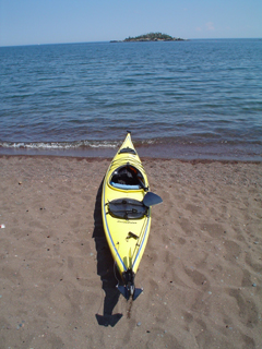
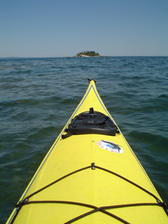
Knife Island CXpedition photos
Click photo for a larger image...