|
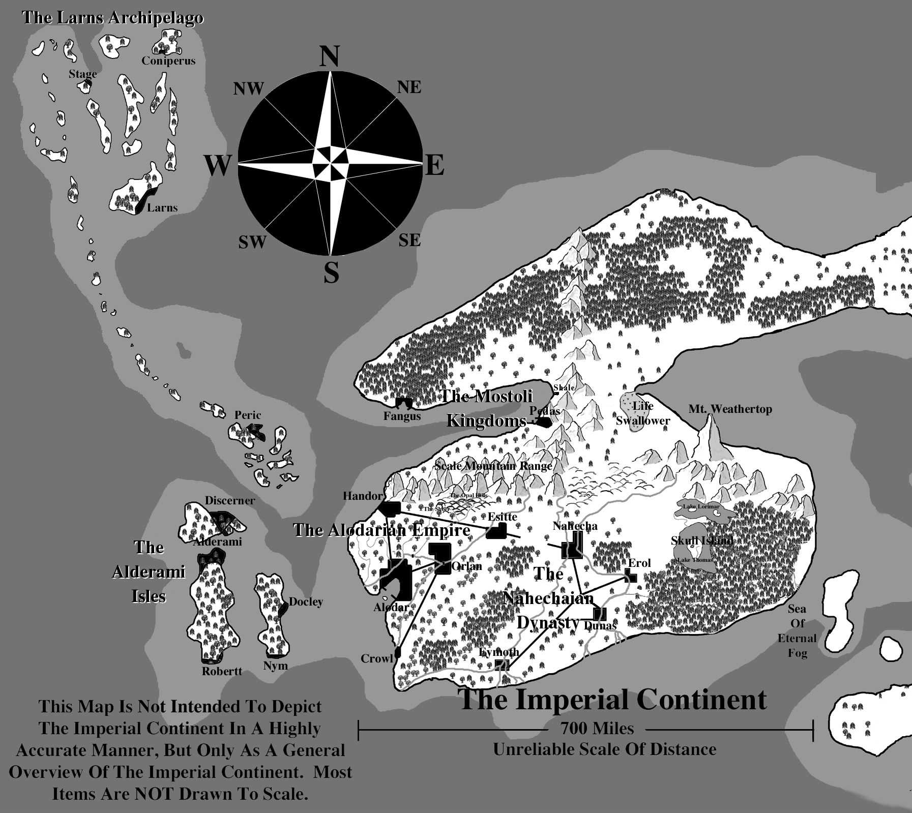
I frequently refer to my first map. It is of the immediate area on the Imperial Continent, but it is by no means the entire map of the planet. Also, when constructing a jpeg image of the map, certain small differences were bound to occur, though that shouldn't matter as this is only meant to convey a general idea of the Alodarian Empire, the Nahechaian Dynasty, the Kingdoms of the Mostoli, the Elven Isles of the Alderami, and the Larns Archipelago. |

© May of 1999
by
James L.R. Beach
Waterville, MN 56096
The Eastern Imperial Continent (The Eastern Portion Of The Imperial Continent.)
The World Map (An Overview Of The Continents Of Orlantia, Their Outline And Shape.)