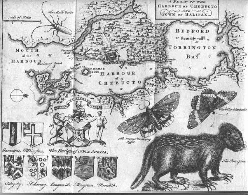
This map, complete with butterflies, porcupine, and coats of arms, depicts the "Harbour of Chebucto and Town of Halifax". Halifax was founded in Nova Scotia in 1749, and this work was published in the July 1750 issue of The Gentleman's Magazine printed in London. It is attributed to Moses Harris,a naturalist and surveyor.