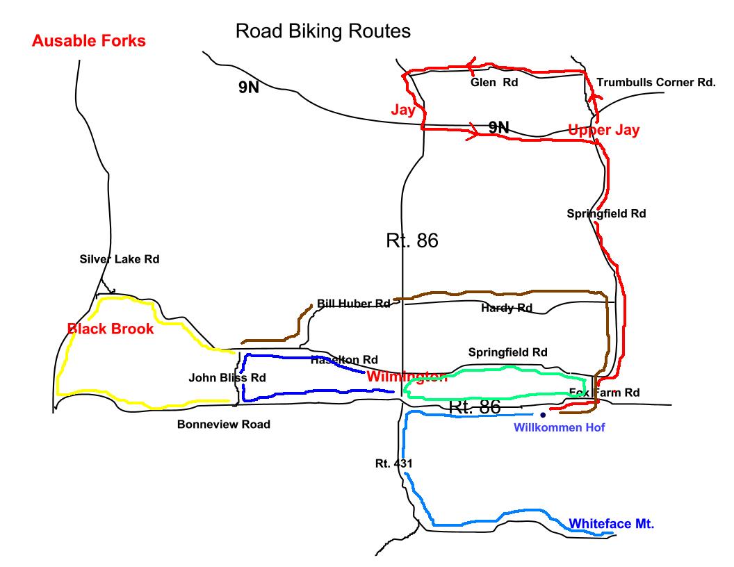
The routes pictured on the following maps can be biked from the
Willkommen Hof B&B. For more information about other biking
opportunities in the Adirondacks, please check out www.champlainbikeways.org
and bert's biking blog.
Route Descriptions
The shortest route is (light
blue) approximately 4 miles. It is relatively easy with
almost no hills. The next route-the Haselton Road Loop (light blue+dark blue) is approximately 9
miles. It is a harder loop with a few hills. The
Black Brook Loop (light blue+dark blue+ yellow) is approximately 17
miles with some hills. It is very scenic going through woods and
along the river valley. Both hill loops are more difficult in one
direction versus the other direction. The Hardy Rd. Loop (brown) adds approximately 3
miles to any of the previously described loops.
The most difficult area loop (blue) is the climb up the
Whiteface Mt. Memorial Highway. This climb can only be done in
the very early morning before the Toll road opens for business or after
it closes in the evening, after 5:30 PM. The ride is
approximately 18.6 miles round trip with an elevation gain of
approximately 3500 ft. with an average grade of 8%. The ride back
down can be very exhilarating, but also very dangerous because of the
poor condition of the road.
The Upper Jay / Jay Loop (red)
is approximately 19 or 20 miles. It is medium
difficulty loop with mixed terrain including some short steep
hills. The arrows define the more difficult direction. For
the more physical riders, loops up to 100 miles are available upon
request.